
10th November, 2019
- Day 1: Fethiye to Ovacık
- Distance: 17.1km
- Ascent / Descent: 700m / 400m
- Weather: 27 degrees C, cool morning hot afternoon
- Accommodation: Sultan Motel, ₺85 pp including bed, breakfast and drinks
- Total cost for one (Turkish Lira ₺): lunch 8, pomegranate juice 12, entrance to Kayakoy ruins 7, accommodation 85, dinner 34 = ₺146 (~£18 / €22 / US$25)
We’re at breakfast for 8am and filling up for the day ahead, trepidatious as we soon step into the unknown… but first a quick detour to a supermarket to top up our food bags with tortillas, Nutella sachets and a few more snacks.
-

- A selection of typical Turkish breakfast goodies
-

- Umbrella street in Fethiye
First stop: supermarket to pick up some food for the hike.
And we’re off (at 10.30am)! We’ve decided to walk this section from Fethiye to Ovacık even though it’s not officially part of the Lycian Way. Reading about the ghost town of Kayaköy that we’ll pass enroute is enough to make us sign up. But first, how do we get out of Fethiye?
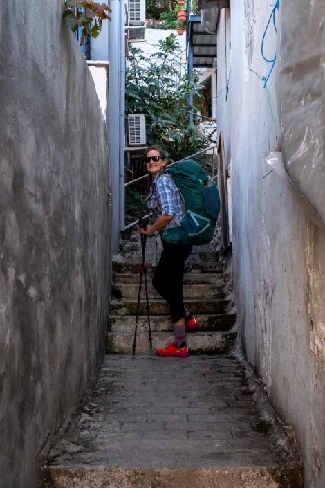
Is this the right way? Trying to leave Fethiye…
The route seems unbelievable and impassable at every turn and this is within the first 10 minutes of trying to leave Fethiye! We find ourselves in people’s gardens and having to pass through gates that we’re not sure we should be, all the while climbing up and up.
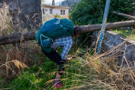
Hmm, are we lost already?!

Hooray, we found a sign, and bees
Finding a sign is a huge relief and the trail is now well waymarked with cairns and red-and-white blazes. It’s also very picturesque and the remaining climb is through pine forest which is a relief as it’s a scorcher today but the shade keeps us cool.

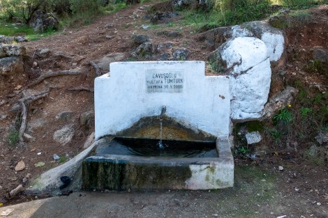
Water source
We do manage to take a few more wrong turns (we don’t have our own GPX track for this section, but we’re making one on the Komoot app as we walk) and then find ourselves in the village of Kayaköy. It’s hot, I’m sweating buckets, so we stop for a pomegranate juice. Sarah’s never been to Turkey before so this is her first pomegranate juice experience… maybe it takes some getting used to… I devour mine and then google the benefits of pomegranates to try and get Sarah onside! Did you know just how incredible pomegranates are?? They’re a superfood on steroids. Forget blueberries, pomegranates are where it’s at.

We stopped for a pomegranate juice (nar suyu) in Kayaköy and saw this lady making traditional bread

Pomegranate juice, yum!

Kayaköy
Refreshed, we continue on our way through the village to the Kayaköy ticket office at the bottom of the hill. (The trail runs right through the middle of the ghost town so you need to buy a ticket to enter.) What was once a sprawling Ancient Greek village, is now a collection of around 500 houses, with the last Greek inhabitants leaving in 1923, during the population exchange between Greece and Turkey. Up we go.
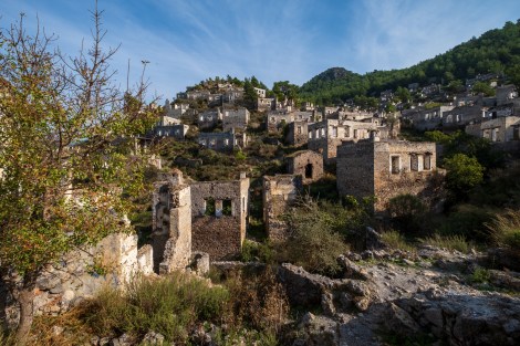
Kayaköy ghost town

Sarah at Kayaköy ghost town
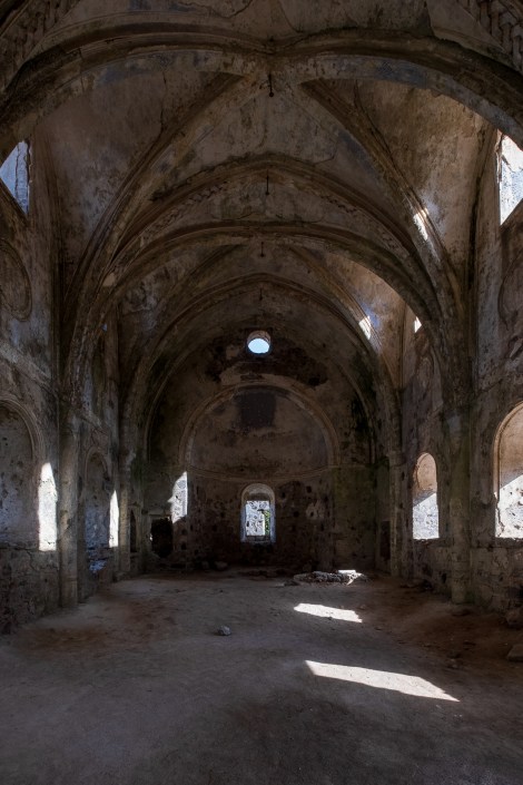
The 19th century Upper Church (Yukari Kilise) in Kayaköy

Looking back down on the old ghost town of Kayaköy
After leaving the ghost town, we ascend through a pine forest with terrific waymarks. At least we think they are, until we start seeing a number of marked trails and we end up on the wrong one! Descending when we should be ascending, we backtrack and bushwhack and try to guess where the trail should be. After some searching we spot a cairn in the distance and make our way there. We’re back on track.

Following the red and white blazes on an easy forest path
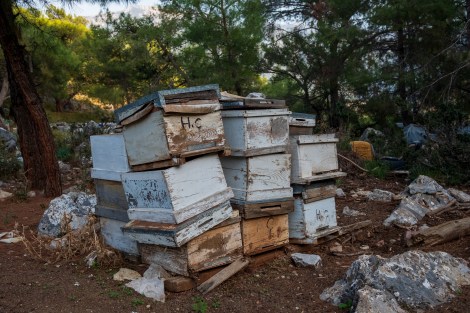
Passing more bee hives
We reach a road and are greeted with a view of these beehives opposite a coastal vista (you’ll have to imagine the sea is to the left of the below pic). The beekeeper gestures for us to come closer but after my bee sting on the Coast to Coast trail in the UK (see this post if you missed it!), I’m a little shy of bees now. Sarah goes over to meet the man and he pulls out a tray from a hive. He motions for her to use her finger to taste the honey. I’m assured it’s delicious!
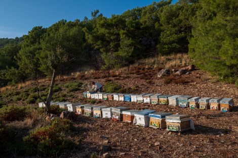
Bee hives and the beekeeper
We descend into Ovacık and it’s almost 5pm. We’ve only sat down once since setting out this morning (to have the pomegranate juice) and we’re feeling it in our legs. We’ve got phone service so we decide to check if there’s any accommodation nearby. There is and it’s very close so we book it. We need to ease into the trail after all. 😉
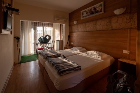
Our room for the night at Sultan Hotel in Ovacık
After a shower and refreshing sundowner, we head back up the hill into the centre of town in search of dinner. It’s an easy choice, there’s only one restaurant (of about a dozen) that’s open. Maybe we should take this as a warning and not expect too much to be open at this time of year, now it’s off-season.
We’d read that today was considered an ‘easy warm-up day’ and what was supposed to take 4.5 hours, took us 6.5 hours! That’s ok, I know it always takes time to settle into a hike (usually about a week for me) especially carrying heavier packs – mine’s about 11kg plus water.
I wonder what a challenging day is going to look like though?!

Dinner menu at the only place open in town!
We order a lahmacun (Turkish pizza) to share and then a meatball wrap. It’s delicious but doesn’t last long for me (post-gall-bladder-removal I’m still finding out what works and what doesn’t). The same happened last night…

We’re using Komoot* for navigation and to record our own tracks. Prior to departing the UK we uploaded the GPX tracks to Komoot so we can now use them for navigation (with voice commands). We’re also using Komoot to record our own daily tracks which gives us the above maps, elevation profiles, distance, speed etc. You can find our collection of tracks on the Komoot App by searching ToughGirl for Sarah and followingthearrows for me. Or click the link in the caption on the above map to go straight to the track.
*Komoot premium was gifted and we also received sponsorship for this hike.
To see Sarah’s vlogs of our Lycian Way hike, click here. You can also follow her on Instagram, Twitter, LinkedIn, YouTube, and keep up to date with the Tough Girl podcasts here.
If you have any questions, leave me a comment and I’ll add a FAQ post at the end of the trip.
