
17th November, 2019
- Day 8: wildcamp near Delikkemer to Bezirgan
- Distance: 16.4km
- Ascent / Descent: 860m / 260m
- Weather: hot, 27 degrees C
- Accommodation: wildcamp in Bezirgan
- Total cost for one (Turkish Lira ₺): resupply at supermarket in Kalkan (water, breakfast bars, cheese, three simit bagels, tissues) 36, brunch in Kalkan 165 = ₺201
(~£26 / €31 / US$34)
I’m woken with the distant sound of the morning call to prayer. I was awake a lot last night and even had to re-inflate my neoair mattress at one point… I think I’ve sprung a leak. During my many bouts of insomnia I was looking into the next stage (using the guidebook, the TrekRight app and the helpful ‘Hike the Lycian Way‘ blog written by an American couple, Betsy and Warren). The guidebook describes it as a ‘narrow and difficult cliff path along the steep rocks,’ then mentioning ‘you have to use your hands.’ The app advises against walking in bad weather or high winds stating that some parts are along a cliff edge. Betsy and Warren took a dolmus (bus) to Kalkan instead.
When Sarah wakes, we discuss the options. There are two:
- Continue along the narrow and difficult cliff-side trail
- Walk 500m down to the road and try to flag a bus to take us to Kalkan
It’s a beautiful day and there’s no wind so we decide to give the trail a go. We can always come back if it’s too hairy.
Near the Delikkemer junction we spot a large tent. I wonder if that’s the people who woke me last night?
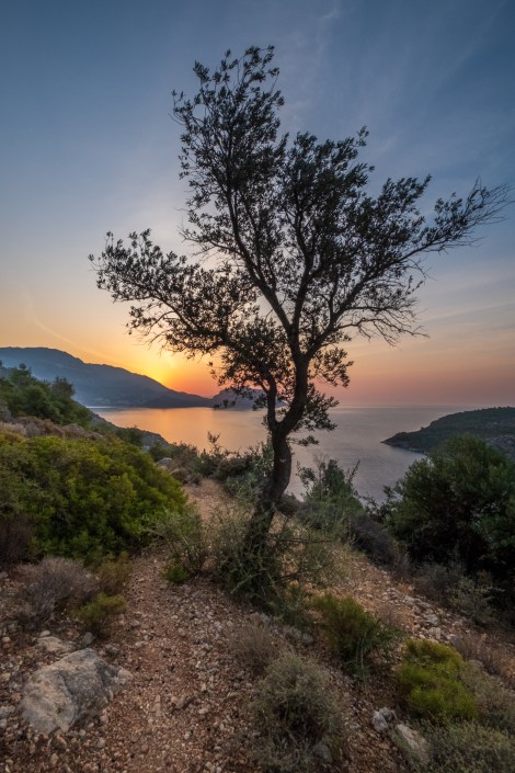
7:55am – wait for it, the sun is just about to rise from behind that hill
7:56am – sunrise near Delikkemer on the Lycian Way
8:15am – rocks, rocks and more rocks
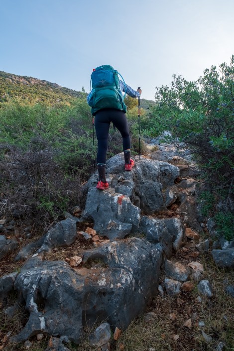
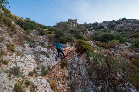
The trail is hairy and gnarly and Type-2 fun and I definitely wouldn’t do it by myself. Unsurprisingly, Sarah’s a great motivator! We scramble over, down and up large boulders and for the most part I have to put my hiking poles away and use my hands. If you have a fear of heights then I don’t recommend this even in good weather. In fact, if you don’t like scrambling, absolutely do not attempt it!

8:26am – this section is gnarly and definitely NOT recommended in bad weather

8:31am – this section is gnarly and definitely NOT recommended in bad weather
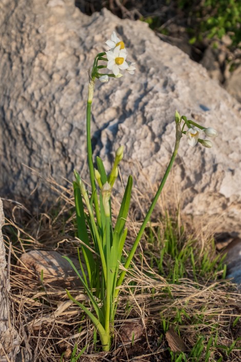
Daffodils on the Lycian Way
8:43am – steep and rocky

8:51am – this section of trail is so crazy we have to check Komoot to make sure we’re really on it!
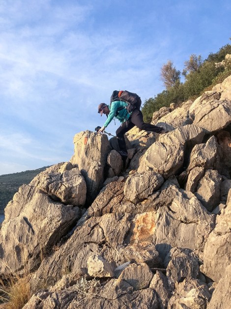
Me scrambling over the rocks to Kalkan (iPhone)

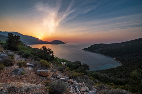
9:27am – that’s what we think is Kalkan, our destination. It looks so close, yet so far!
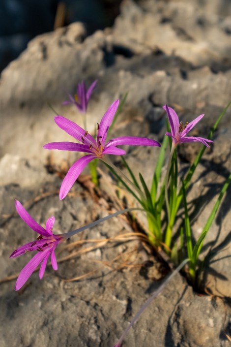
Crocus

We thought that was Kalkan, now we realise Kalkan is actually the next bay over and out of view!

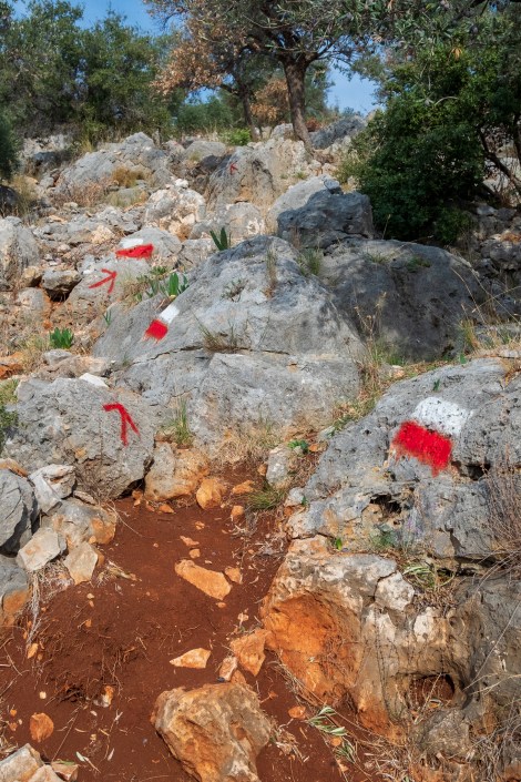
We follow and rely on cairns just as make as the blazes
After 3.5km of scrambling, taking 2 hours, we reach a road, breathe a sigh of relief, and follow this the rest of the way to Kalkan. We do a quick resupply at the Migros supermarket, then, ravenous we stop at the first cafe serving breakfast. We stay three hours and gorge on breakfast, lunch and dessert as well as charging our electronics!
-
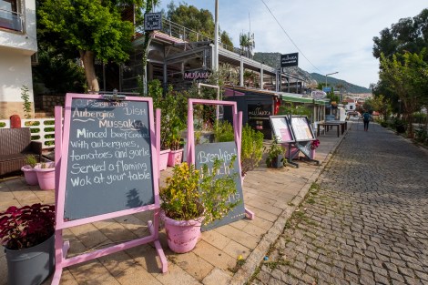
- We stop for breakfast at Mussakka in Kalkan and we stay for breakfast, lunch and dessert!
-
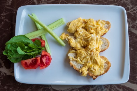
- scrambled eggs for brekkie
-

- followed by pasta
-

- and baklava to finish
It’s 2:30pm when we finally set off again and I’m in pain as my hip-belt digs into a stomach full of food! We’ve got 10km and an 800m ascent to reach our chosen destination of Bezirgan.
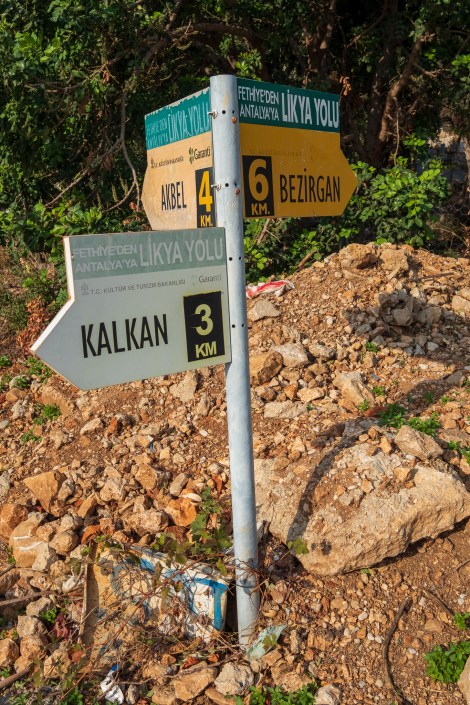
The initial few kilometres climbing up out of Kalkan are along the main road (D400). It starts off with a footpath, but this disappears and we’re walking along the shoulder. We turn off onto a trail through scrub which gets wider, but rockier as we continue climbing. There’s switchbacks almost the whole way to the top, so it’s not so bad.
3:10pm – wow, someone was trying to use up some paint!

A camping spot set to open up in 2020

So sweet!
4:!2pm – 6km to go to our destination of Bezirgan

4:36pm – a helpful cairn

5:11pm -what happened to this section of trail?… it looks so walkable!
Sunset is impressive but we’re now racing against the darkness.

5:41pm – grain huts (ambar) at the entrance to Bezirgan
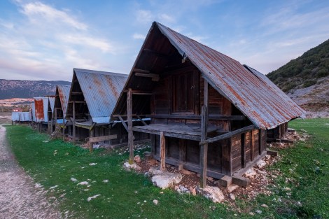
Grain huts (ambar) at the entrance to Bezirgan
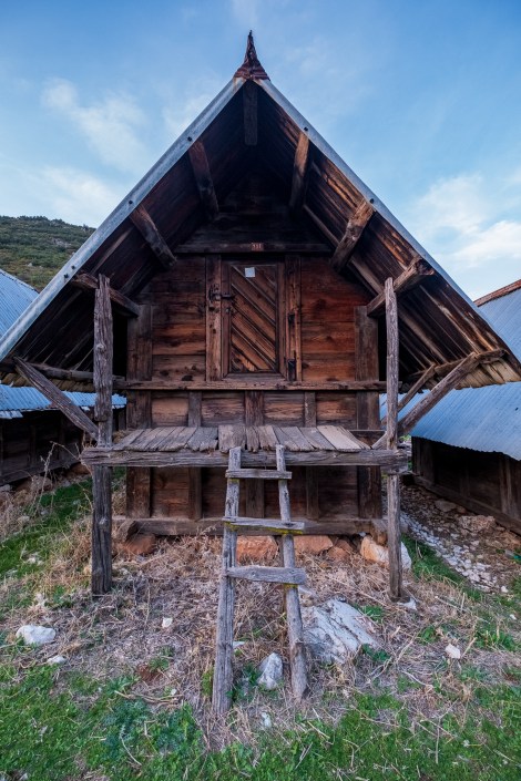
Grain huts (ambar) at the entrance to Bezirgan
We’ve chosen Bezirgan as our destination purely for water reasons but as we walk along the main road into the village, we’re struggling to find anywhere suitable to set up camp. There’s plenty of abandoned houses, but we’d prefer to ask permission and there’s no-one around. We’ve read that in some villages you can ask the head of the Mosque for permission to camp nearby so that’s where we make a beeline to. It’s dark when we arrive and there’s not a soul in sight… We continue searching and find a field away from the road that seems like it will do. I really wish my tent wasn’t bright orange!
We’re in a valley and it’s windy. It’s 9pm and we’ve also now been spotted by a local gang of dogs who are barking and snarling at our tents. “Where are your poles Sarah?’ I call out. “Outside,” she replies. Mine too…

Lycian Way – route information by Komoot – day 8
We’re using Komoot* for navigation and to record our own tracks. Prior to departing the UK we uploaded the GPX tracks to Komoot so we can now use them for navigation (with voice commands). We’re also using Komoot to record our own daily tracks which gives us the above maps, elevation profiles, distance, speed etc. You can find our collection of tracks on the Komoot App by searching ToughGirl for Sarah and followingthearrows for me. Or click the link in the caption on the above map to go straight to the track.
*Komoot premium was gifted and we also received sponsorship for this hike.
To see Sarah’s vlogs of our Lycian Way hike, click here. You can also follow her on Instagram, Twitter, LinkedIn, YouTube, and keep up to date with the Tough Girl podcasts here.
If you have any questions, leave me a comment and I’ll add a FAQ post at the end of the trip.
