
18th November, 2019
- Day 9: Bezirgan to a wildcamp 8km past Gökceören
- Distance: 24.7km
- Ascent / Descent: 750m / 920m
- Weather: sunny but with a cool breeze, 24 degrees C
- Accommodation: wildcamp 8km past Gökceören
- Total cost for one (Turkish Lira ₺): 0
If you can hear the above audio file, you’ll know what woke me up at 5:30am. The morning call to prayer around 6:30am woke me up next.
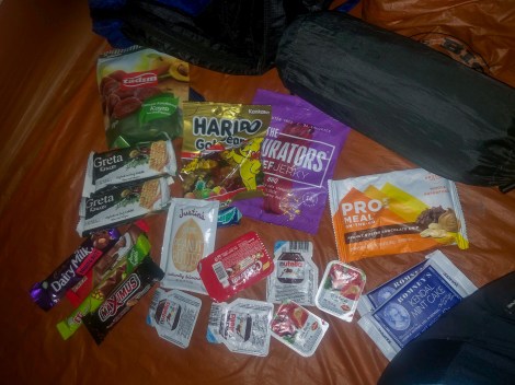
Breakfast options – apricots will do
It’s quite the luxury having a toilet block and running water nearby. We fill up with 3L believing this is the last water source for the next 17km until Gökçeören.
Leaving Bezirgan, we’re joined by a dog and name it Bob. We’ve had quite a few dogs follow us for a few kilometres here and there over the past week. They seem to come and go.
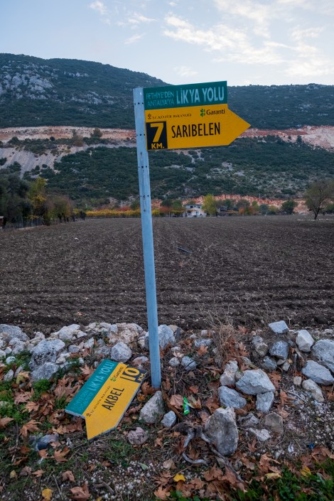
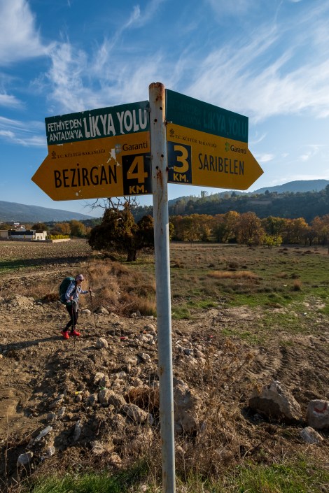
7:58am – 7km to Sarıbelen…
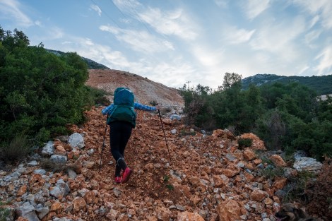
Within 15 minutes of starting, we’re climbing up a steep rock-strewn hill out of the valley.
8:21am – of course this is the trail
8:45am – what goes up… must go up and down and up and down and up and…
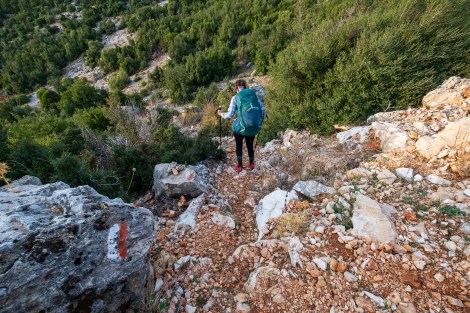
8:56am – note the red and white blaze on the rock, we’re still on the trail
9:07am
9:48am – that was a tough 4km!
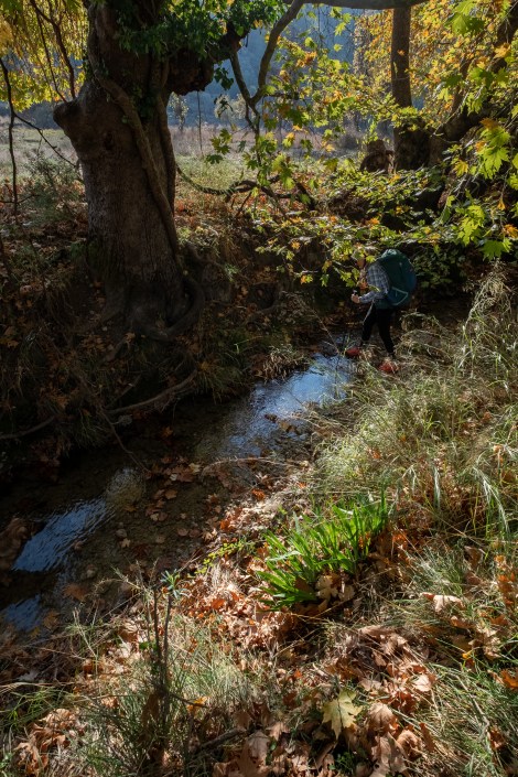
9:54am – this stream crossing was unexpected
We reach a road and pass a couple of houses, a bench and two water fonts, then realise we’re in the lower village of Sarıbelen. We take advantage of the bench, guzzle down water and refill.
We leave the comfort of the bench and follow what we assume to be the trail, down the road. The blazes run out and we spot a cairn on the side of the road. We assume this means we leave the road, an easy assumption considering we’re often following cairns just as much as blazes. We check the app and it does show a trail, but it’s not our trail, it’s not the Lycian Way.
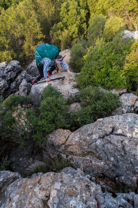
Oops. We can backtrack to that comfy bench, then actually follow our app the right way, or we can attempt the trail in front of us. I refer to the word ‘trail’ quite loosely here. In front of us is a boulder field. We appear to be at the bottom of a steep dry waterfall. How hard can it be? …
DO NOT FOLLOW IN OUR FOOTSTEPS.
Oh dear. We find ourselves climbing boulders bigger than the two of us. At one point we have to take our packs off and pass them up one by one. It’s impossible to go through the scrub, maybe there was once a trail but there certainly isn’t anymore. It’s back-breaking, literally and I’m having to control my breathing for fear of panicking. ‘Do something that scares you everyday,’ they say. (F**k that). Sarah’s great, in fact she’s badass. Thank God I’m not with another version of myself!
Amazingly we make it. I kiss the ground. If I ever had 9 lives, I’m sure I’ve just sacrificed one. Even more amazingly, Bob, the dog makes it too. Unbelievable.
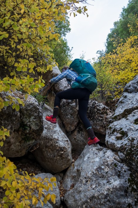
11:14am – and this was also unexpected and a mistake – THIS IS NOT THE LYCIAN WAY – DON’T ATTEMPT IT!
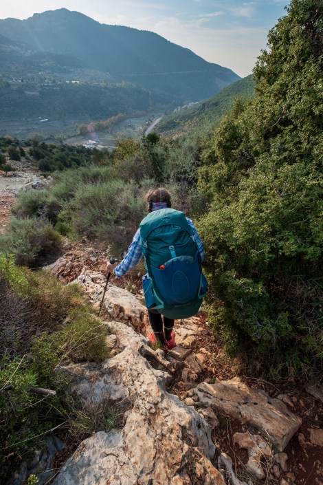
Back on the Lycian Way, we pass high valleys, goats, a shepherd’s hut and are treated to splendid autumn foliage.
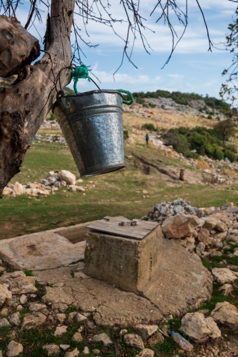
12:40pm – a well with it’s own bucket
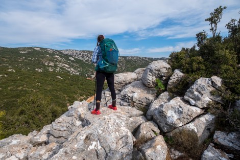
12:53pm – taking a breather and soaking up the views
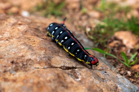
A colourful caterpillar – anyone know what it is?
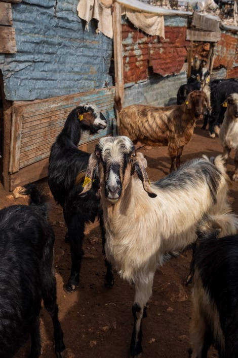
A common sight on the Lycian Way
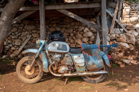
1:14pm – a retro motorbike
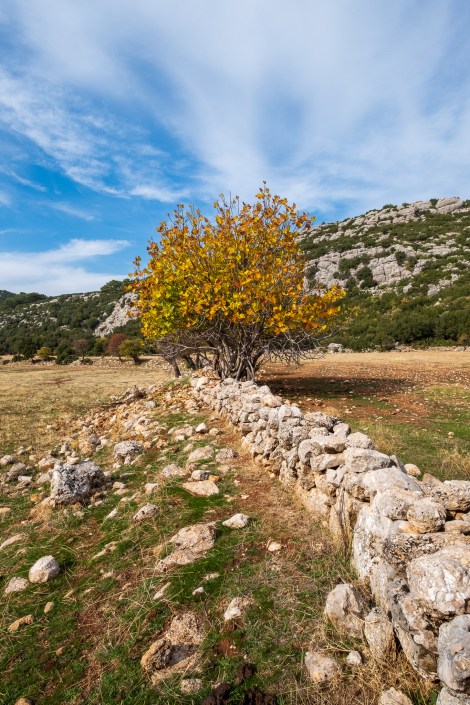
1:58pm – autumn colours
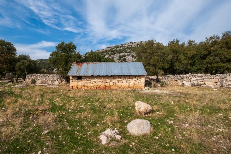
A shepherds hut
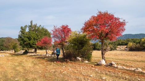
2:52pm – Sarah and our tag-along dog (we called her Bob) passing more autumn colours
We finally make it to Gökçeören at 3:30pm and we’re feeling the after-effects of exerting all our energy to climb that boulder field this morning. The terrain ever since has been easy, but we’re tired. We pass a tap and fill up with water for the next 20km. I’m carrying 3L seeing that it will be dark (and cold) soon, and we should make most of the miles tomorrow morning before it gets too hot. We hope to make it to a camp spot 8km away before dark.
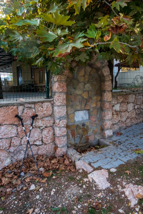
3:47pm – stopping to refill water in Gökçeören
To our delight, we follow a paved road and then a dirt road for the next 8km, all the way to the area we’re hoping to camp. With no obstacles underfoot we pick up the speed and play different variations of the A-Z word game (ie. names (boys and girls) / countries / cities / hiking gear etc). The first person has to say one starting with the letter A, the other person then says one starting with B etc. Before we know it, we’re at our destination and all that’s left to do is scout out the perfect place to camp. There’s a raging river here too. I wish we’d known that before lugging 3L here!
The temperature drops dramatically so we have a quick dinner then retreat to the warmth of our sleeping bags.

5:50pm – our gorgeous camp spot for the night
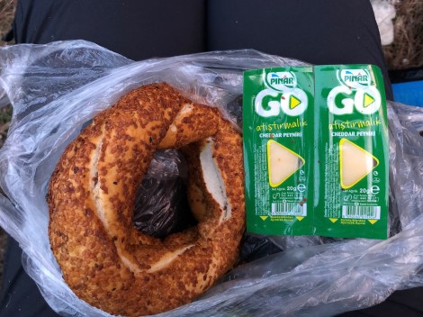
Tonight’s dinner – a simit (bagel) and cheese

Lycian Way – route information by Komoot – day 9
We’re using Komoot* for navigation and to record our own tracks. Prior to departing the UK we uploaded the GPX tracks to Komoot so we can now use them for navigation (with voice commands). We’re also using Komoot to record our own daily tracks which gives us the above maps, elevation profiles, distance, speed etc. You can find our collection of tracks on the Komoot App by searching ToughGirl for Sarah and followingthearrows for me. Or click the link in the caption on the above map to go straight to the track.
*Komoot premium was gifted and we also received sponsorship for this hike.
To see Sarah’s vlogs of our Lycian Way hike, click here. You can also follow her on Instagram, Twitter, LinkedIn, YouTube, and keep up to date with the Tough Girl podcasts here.
If you have any questions, leave me a comment and I’ll add a FAQ post at the end of the trip.

…could you have avoided wild-camping all along somehow? If so, how would you have configured your overnights at an accommodation somehow somewhere throughout? Did you ask “Bob” for Her opinion—since She probably knew more than both of you—I wonder?
LikeLike
Yes, the only section where there’s no accommodation is the three-day mountain stage between Demre and Finike, otherwise if you plan ahead you can stay in accom for the whole trail.
LikeLike
…that caterpillar is called the “Leafy Spurge Hawkmoth.” Very handsome, indeed! All dressed up; but no place go though! How long was it?
LikeLiked by 1 person
Awesome, thank you for identifying the caterpillar! It was about ~7cm long.
LikeLike