
19th November, 2019
- Day 10: wildcamp 8km past Gökceören to Kaş
- Distance: 21.2km
- Ascent / Descent: 540m / 1090m
- Weather: sunny, 23 degrees C
- Accommodation: Santosa Pansiyon ₺90pp (including breakfast and washing)
- Total cost for one (Turkish Lira ₺): accommodation 90, dinner at Öz Nazilli Restoran 35 = ₺125 (~£16 / €19 / US$21)
Bob barked all through the night so I came up with an acronym for her name (Bugger Off Bob). It didn’t work and she’s still with us. I also woke through the night because of the cold. It was freezing and I had to put on every layer I have: thermal pj’s, hiking clothes, wind jacket, down jacket, beanie and gloves. This meant I had no pillow because I sleep on my clothes bag!
It’s 7am and still freezing. As freezing as you’d expect camping next to a stream 556m above sea level. My tent has succumbed to condensation and I struggle to pack it up with frozen, numb fingers. Brrrr. Let this be the last time we camp next to a stream on the Lycian Way!
We get going and are soon climbing up to the highpoint of the day at 1034m. Luckily it doesn’t take long to get warm.
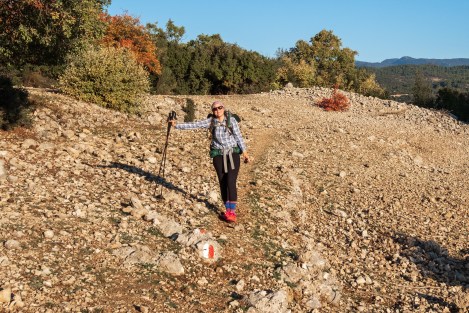
8:46am – Sarah basking in the warmth of the sun
The pops of autumn colours are beautiful; yellow, orange and red trees dot the landscape.

9:05am – a shepherds hut in the mountains on the Lycian Way
At the highpoint we find a large flat area and dry our tents. Bob’s still with us and she takes this opportunity to try repeatedly to hump Sarah’s leg. It’s hilarious. I mean it’s really annoying. Bugger off Bob.

10:10am – drying out our tents
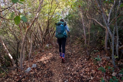
We begin to descend on a mix of trail and dirt roads and after 4km we reach the site of Phellos ruins.

11:02am – it’s nice to hit a forest road every now and then to give our ankles a rest!
11:54am – on our way to the Phellos ruins
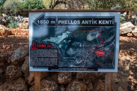
Phellos ruins
The site is on top of a hill and overgrown. Indiana Jones eat your heart out. There are tombs, columns, inscriptions and much more buried in the undergrowth. It’s quite spectacular.

12:10pm – exploring the tombs of Phellos ruins
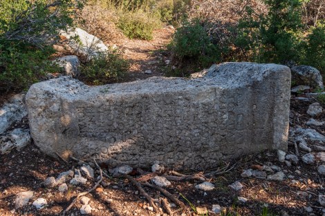
Phellos ruins

A tomb at Phellos ruins
We leave Phellos and descend to the village of Pınarbaşı. We refill water and continue downhill along a dirt road for the next five kilometres until we reach the beginning of the DESCENT TO KAŞ.
Nah, it’s not that bad. We just have to drop 500m over 2km to get to sea level. It helps that we’ve read how steep it is so we’re mentally prepared. It also helps that the views are second-to-none. I extend my poles to a setting they’ve never been before and we start.
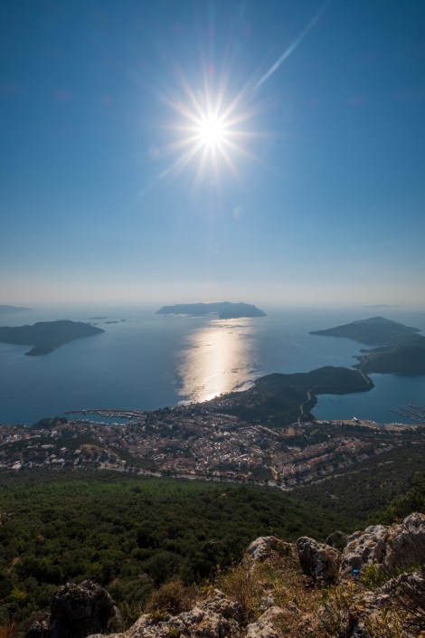
Looking down on the town of Kaş
The descent is switchbacks which helps immensely but it is steep and my legs turn to jelly when I stop.
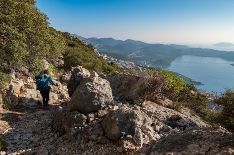
3:35pm – descending to Kaş
We lose Bob in Kaş. I hope she knows how to look after herself in the big-smoke. We met her in a tiny village after all. Good luck Bob.
We book into Santosa Pansiyon, arrange for breakfast to be takeaway (a cheese and tomato baguette with a boiled egg), hand over our dirty laundry, then shower and head out for dinner.

Santosa Pansiyon, Kaş
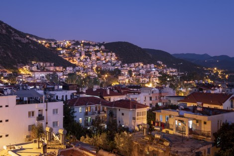
6:23pm – night view of Kaş from our pension
Just around the corner from the Pension, we find Öz Nazilli Restaurant. It’s bustling with locals and there’s only one table left, just for us. The meal is perfect, as is the baklava from the cafe next door.
-

- Shepherd’s salad to start at Öz Nazilli in Kas
-

- Tavuk Siş for main
-

- Baklava for dessert from the café next door
We do a quick resupply at a nearby supermarket called Bim. We quickly realise it’s a discount supermarket and are amazed at how cheap everything is. The one thing I can’t buy is antibacterial hand gel. I go to the Migros supermarket nearby and they don’t have any either. Neither does the Co-op across the road. Maybe the pharmacy? Nope. Strange.
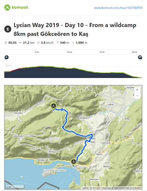
Lycian Way – route information by Komoot – day 10
We’re using Komoot* for navigation and to record our own tracks. Prior to departing the UK we uploaded the GPX tracks to Komoot so we can now use them for navigation (with voice commands). We’re also using Komoot to record our own daily tracks which gives us the above maps, elevation profiles, distance, speed etc. You can find our collection of tracks on the Komoot App by searching ToughGirl for Sarah and followingthearrows for me. Or click the link in the caption on the above map to go straight to the track.
*Komoot premium was gifted and we also received sponsorship for this hike.
To see Sarah’s vlogs of our Lycian Way hike, click here. You can also follow her on Instagram, Twitter, LinkedIn, YouTube, and keep up to date with the Tough Girl podcasts here.
If you have any questions, leave me a comment and I’ll add a FAQ post at the end of the trip.
