
- Day 43 – Minami Sanriku to Michi-no-eki Sanriku
- Distance: 90.9km
- Ascent / descent: 1321m / 1198m
- Weather: sunny
- Accommodation: camped near Michi-no-eki Sanriku
Breakfast was a little hard to stomach this morning, slightly on the raw and fishy side. I know I’m in Japan and this is to be expected – give me a piece of grilled salmon, rice and miso soup for breakfast any day of the week and I’ll happily eat it, but today’s was a little too fishy. I ate a few bowls of rice, lapped up the miso soup, ate the pickles, but had to leave the slimy squid (pink substance on RHS), mackerel (I had a nibble), natto (fermented soy beans, top left in plastic), kamaboko (fish mince in the top of the picture) and the raw egg (I was so excited when I first saw it thinking it was a hard-boiled egg!) Call me fussy.
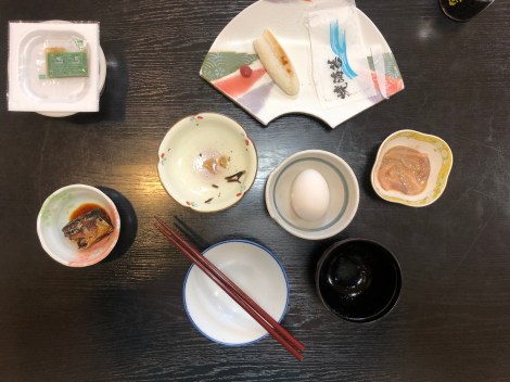
Breakfast of mackerel, natto (top left), squid, raw egg and fish paste
When I left the minshuku, the mother kindly gave me two rice balls to take away for lunch, commenting that there was no fish inside so they wouldn’t spoil. She’d obviously seen my breakfast remains!
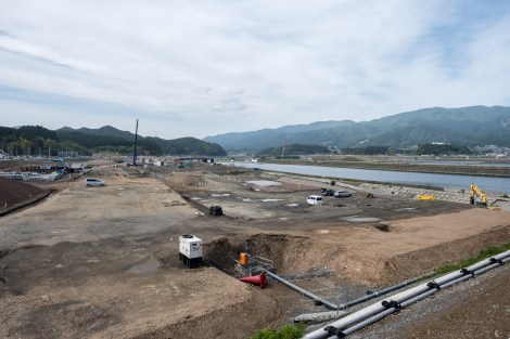
I was following a GPS track for the Tohoku region but it seemed out of date (it appears to be from 2016) as many of the roads it suggested ended up as dead ends or gravel paths and many were blocked off due to the tsunami recovery work. It was slow going. It was also quite shocking. I passed through numerous tsunami affected areas, all with ongoing construction. It was hard to believe the tsunami hit 8 years ago but it still seemed so recent here. How was this not fixed yet?
According to Britannica:
‘The magnitude 9.0 earthquake struck at 2:46 PM. The epicentre was located some 80 miles (130 km) east of the city of Sendai, Miyagi prefecture, and the focus occurred at a depth of 18.6 miles (about 30 km) below the floor of the western Pacific Ocean…
Hundreds of aftershocks, dozens of magnitude 6.0 or greater and two of magnitude 7.0 or greater, followed in the days and weeks after the main quake. The March 11, 2011, earthquake was the strongest to strike the region since the beginning of record keeping in the late 19th century, and it is considered one of the most powerful earthquakes ever recorded…
A wave measuring some 33 feet high inundated the coast and flooded parts of the city of Sendai, including its airport and the surrounding countryside. … Damaging tsunami waves struck the coasts of Iwate prefecture, just north of Miyagi prefecture, and Fukushima, Ibaraki, and Chiba, the prefectures extending along the Pacific coast south of Miyagi. In addition to Sendai, other communities hard-hit by the tsunami included Kamaishi and Miyako in Iwate; Ishinomaki, Kesennuma, and Shiogama in Miyagi; and Kitaibaraki and Hitachinaka in Ibaraki. As the floodwaters retreated back to the sea, they carried with them enormous quantities of debris, as well as thousands of victims caught in the deluge. Large stretches of land were left submerged under seawater, particularly in lower-lying areas.
Ultimately, the official total for the number of those confirmed dead or listed as missing from the disaster was about 18,500, although other estimates gave a final toll of at least 20,000.’

Ongoing road construction in the tsunami inundation area

Ongoing road construction in the tsunami inundation area
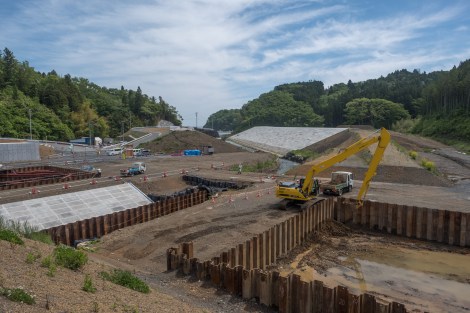
Ongoing road construction in the tsunami inundation area

Beautiful coastline
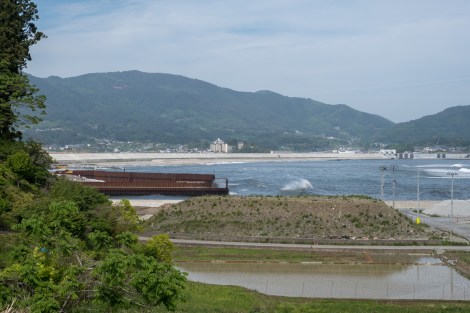
Building a giant wall along the coastline that was affected in the 2011 tsunami
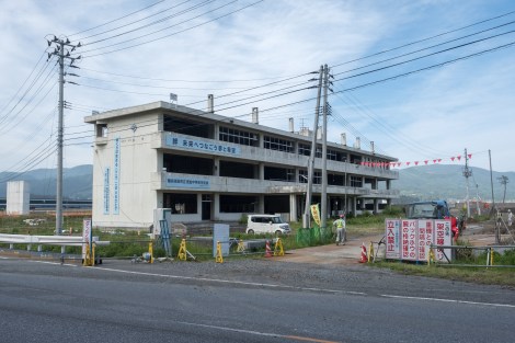
This Junior High School in Rikuzentakata has been left as a reminder of the 2011 tsunami

This Junior High School in Rikuzentakata has been left as a reminder of the 2011 tsunami
This area didn’t look much different to me than it did when I drove through here in 2014. I wonder why the recovery is taking so long? Is it money? Maybe the residents don’t want to move back? Is the ground unstable? Maybe this is how long it takes to repair an area that has been so badly damaged? I had so many questions as I was cycling along. I also started thinking about the Tokyo Olympics. I was an avid supporter for the Olympics in Japan but cycling through here made me almost angry that Japan is hosting the Rugby World Cup this year and the Olympics next year, when so much of this coastline hasn’t been repaired and news reports show that residents are still displaced. Maybe I’ve got it all wrong, I have no idea of the politics of the situation or even if it is about money. But if it is, then surely this should be the top priority?
This is Rikusentakata, one of the worst hit areas of the 2011 tsunami
The area of Rikuzentakata was one of the worst hit areas, inundated by 13m high waves. Before the tsunami, the area was known for its two-kilometre long shoreline with an estimated 70,000 pine trees called Takata Matsubara. After the tsunami, only one was left standing and it was dubbed the ‘miracle pine tree.’ Unfortunately this pine tree eventually died but a replica was installed as a memorial. In the below picture behind the pine tree you can see the seawall that is being constructed along the coastline.
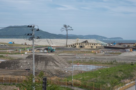
The miracle pine tree memorial in Rikusentakata, one of the worst hit areas of the 2011 tsunami

Michi-no-eki Takata Matsubara in Rikuzentakata which was destroyed by the tsunami

Inside all of the tsunami inundation areas along this coast are these signs telling you how long the inundation area is. For example this sign says the area starts 2,600m behind and ends 1,950m ahead.

Only the top level of this five-story apartment building in Rikuzentakata was unaffected
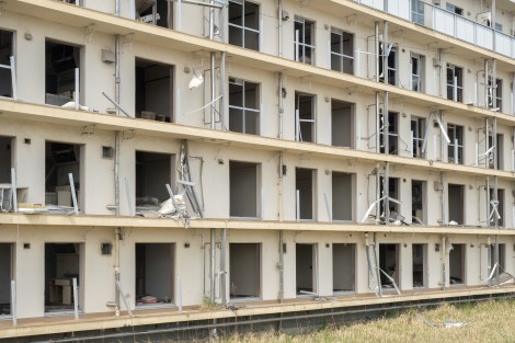
Only the top level of this five-story apartment building in Rikuzentakata was unaffected

Delicious rice balls for lunch, a present from Minshuku Shitamichisou
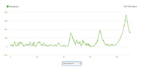
Jb43 – elevation profile from Garmin connect
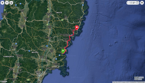
Jb43 – google map from Garmin Connect
