
1st December, 2019
- Day 22: Hısarçandır to Antalya
- Distance: 21.2km
- Ascent / Descent: 80m / 930m
- Weather: overcast
- Accommodation: Yonca Butik Hotel in Adrasan, ₺160pp
- Total cost for one (Turkish Lira ₺): snacks (2x boiled eggs and soda water) 6, dolmus from Antalya to Adrasan 14, taxi 10, accommodation and dinner 160 = ₺190 (~£24 / €29 / US$32)
We leave early and I take my phone off airplane mode, hoping to get service so I can check the weather. It’s overcast and cold and looks like it could break into rain at any moment. Before long, my phone pings with emails and messages and I see what we’d already guessed, we’re in for more rain, with a high chance from 9am. We’re walking along the road and are almost at the turn off to descend steeply along a trail to the bottom of the valley before climbing back up – we can see exactly where it goes and are already questioning why anyone would want to do that?! Hısarçandır (where we’ve just left) was the original end point of the trail, but it’s been extended closer to Antalya. The road we’re on now goes go Antalya, it’s 30km away according to the big blue road sign. We look at each other and silently nod agreeing, we’ll happily walk the 30km along the road to Antalya.

8:20am – 30km to Antalya and the coldest morning yet
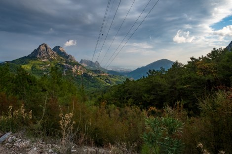
9:33am – that’s Antalya, way over there in the distance by the sea
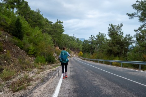
And we’re taking the road

11am – final mountain views
After 18km we stop at a bench in a park to eat lunch and reconvene. We have a couple of options – we can keep walking all the way to Antalya and stay the night or, now that it’s still early, we can try and find a bus to take us back to Adrasan to finish the Gelidonya lighthouse section that we had to skip on day 17 due to bad weather. While we’re weighing up the options, a young girl walks into the park with her mum and walks right past us. I ask if she speaks English and she’s practically fluent. I tell her we’d like to get to Adrasan and she shows us where the nearest bus station is on google maps, only 3km away.
It seems easy so we walk to the bus stop, except that once we get to where it should be, there’s nothing but a highway and shopping centre. We ask another local and he tells us to wait on the highway next to the pedestrian overpass. Of course! There’s no ‘bus stop’ or sign, but he assures us the driver will stop if they see us waiting. The rain starts and we take cover under the overpass. The first bus (dolmuş) approaches and we duck out to flag it down but it’s not going to Adrasan. The second one is however, and the driver stops on the busy highway, gets out and opens the luggage compartment for our packs, then we get on and pay him the ₺14pp ticket. It’s remarkably simple and smooth.
A storm hits while we’re on the bus and the roads soon become flooded. We’re lucky to have escaped the rain, again. The driver makes a few more pick-ups then stops for a tea break and after an hour or so we’re dropped off on the D400, 15km north of Adrasan. There’s a car waiting to meet the bus and the driver gets out and greets us saying “taxi.” We’ve found a hotel to stay in Adrasan near the trail so we agree a price with the taxi driver and he drops us off at the door.
-

- 1:45pm – but we have unfinished business (the lighthouse section of trail near Adrasan) so we get the bus back from Antalya (iPhone)
-

- 6:04pm – the stove at our accommodation, Yonca Butik Hotel in Adrasan (iPhone)
-
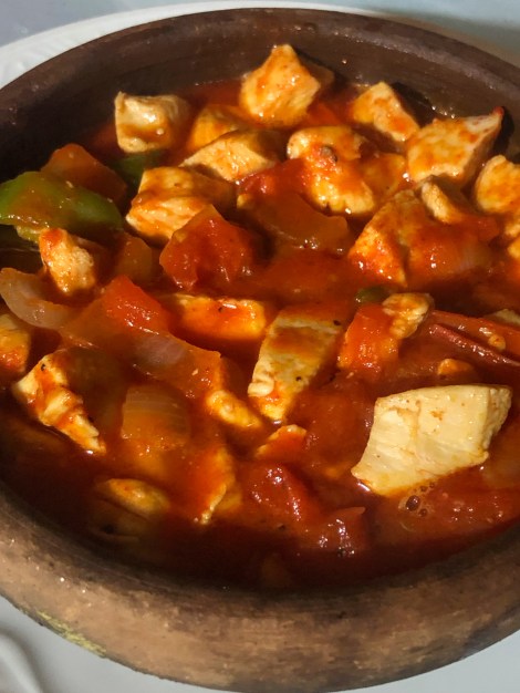
- Chicken hot pot for dinner
-
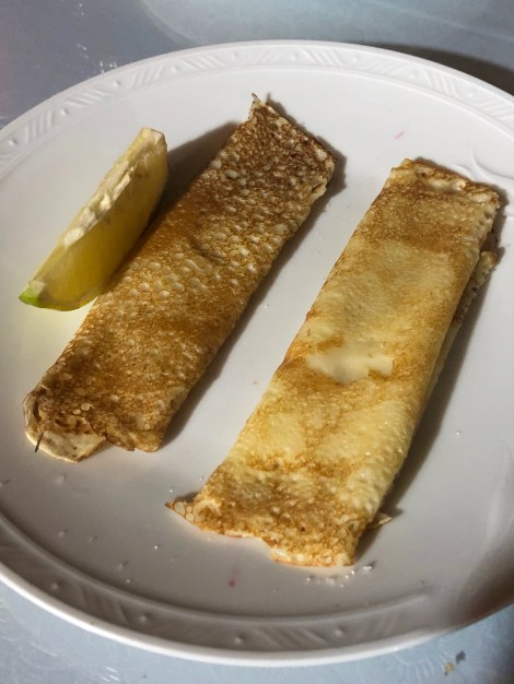
- Crepes with lemon and sugar for dessert (iPhone)
We check-in and arrange to have dinner and breakfast at the hotel. We’re going to walk the Gelidonya lighthouse section tomorrow from here (in reverse, from east to west) meaning we’ll hit the rugged section first to reach the lighthouse and have the ‘easier’ forest trail at the end of the day after leaving the lighthouse. After this afternoon’s heavy rain, we agree it’s best to have a leisurely morning tomorrow and give the trail a chance to dry in the sun.
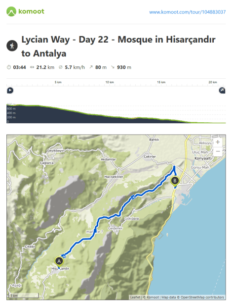
Lycian Way – route information by Komoot – day 22
We’re using Komoot* for navigation and to record our own tracks. Prior to departing the UK we uploaded the GPX tracks to Komoot so we can now use them for navigation (with voice commands). We’re also using Komoot to record our own daily tracks which gives us the above maps, elevation profiles, distance, speed etc. You can find our collection of tracks on the Komoot App by searching ToughGirl for Sarah and followingthearrows for me. Or click the link in the caption on the above map to go straight to the track.
*Komoot premium was gifted and we also received sponsorship for this hike.
To see Sarah’s vlogs of our Lycian Way hike, click here. You can also follow her on Instagram, Twitter, LinkedIn, YouTube, and keep up to date with the Tough Girl podcasts here.
If you have any questions, leave me a comment and I’ll add a FAQ post at the end of the trip.
