
15th November, 2019
- Day 6: Çavdır to wildcamp near Delikkemer
- Distance: 21.1km
- Ascent / Descent: 560m / 450m
- Weather: sunny, 23 degrees C
- Accommodation: wildcamp near Delikkemer
- Total cost for one (Turkish Lira ₺): water 2, snacks at market in Üzümlü 14, snacks at in Akbel 19 = ₺35 (~£4 / €5 / US$6)
After a wonderful night’s sleep, we have breakfast just before 8am. Today’s home-made condiments include (but are not limited to), honey, grape/molasses syrup, tahini paste, Nutella, white chocolate spread, grape jam, strawberry jam, fig jam, olive oil etc. Our tastebuds are sent on an exotic tour as we devour each one on the fresh bread.
-
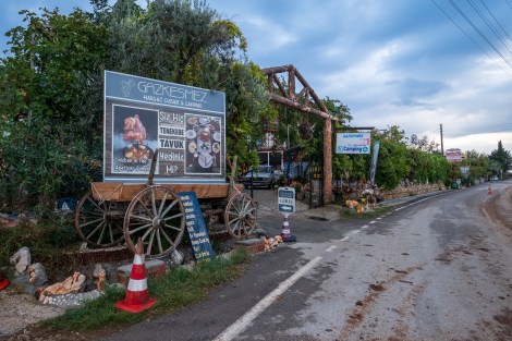
- Gazkesmez Margaz cuisine and camping
-
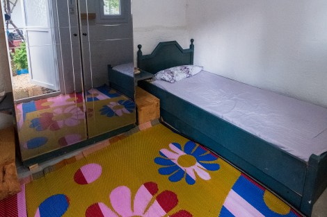
- Our twin room
-

- Spoilt for choice with our breakfast condiments
-
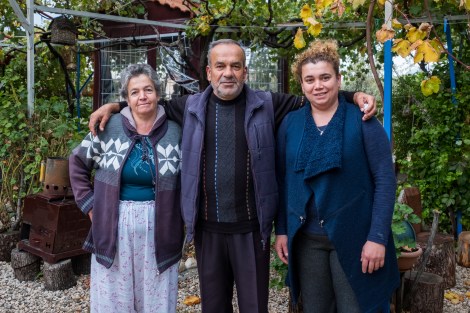
- Our hosts
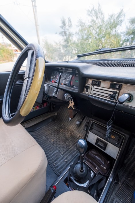
9:18am – Renault 12 TSW 1400
We’re dropped back off where we were picked up yesterday at 9:15am. The temperature is cool and perfect for walking and thankfully the rain has stopped.

A traditional headstone at Çavdır cemetery
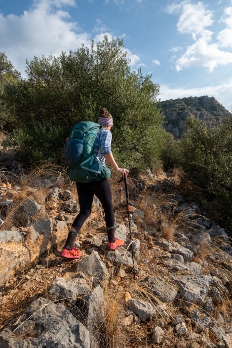
We spend most of the day walking along an ancient Roman aqueduct and after yesterday’s storm there’s quite a bit of water to navigate around. The path is often overgrown, very stony underfoot and now slippery and wet. It’s beautiful but each step takes concentration. I’m so glad we didn’t attempt this yesterday in the rain, especially as I can take photos today.
10:09am – believe it or not, we’re on a Roman aqueduct!

10:13am – see! Roman aqueduct

Walking along an ancient Roman aqueduct

Me on an ancient Roman aqueduct (iPhone)

10:32am – Roman aqueduct

Roman aqueduct

11am – Roman aqueduct

Mosque and mountains

Roman aqueduct

11:26am – Sarah pushing through the brambles

12:21am – looking back at the greenhouses of Letoon, two nights ago we were camped on a deck by the beach in the top of this photo

Pomegranates everywhere
We reach Üzümlü around 1pm and stop for a quick break. There’s a mosque near the trailhead (water and WC) and a market so we buy some snacks, refill water and continue on. We cross a stream then climb back up through the valley along a narrow and very thorny trail.
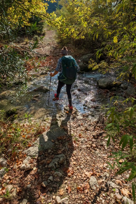
2:26pm – lots of water since the storm

Thorns EVERYWHERE

2:54pm – and an ever-changing scenery

4:13pm – market in Akbel
We refill water again in Akbel – this is our last guaranteed water source until we reach Gelemiş (Patara village) tomorrow, roughly 13km away. I drink 1L here, then carry 4L and notice every ounce of it on my back! The trail is even narrower and more thorny than before.
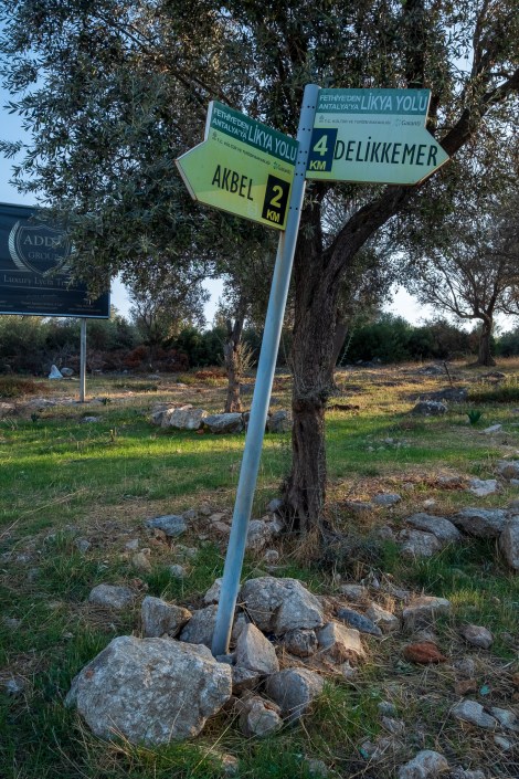
4km to Delikkemer

Me and my trusty Gossamer Gear Mariposa backpack (iPhone)
Thorns… (iPhone)
At 5:30pm we stop at what looks like a potential camp site. It’s rocky but the view is worth it, so we set up.

Dinner options (iPhone)

And then I found a packet of Doritos buried deep in my pack! Doritos and maple almond butter… not bad at all! (iPhone)

6:02pm – camping with a view
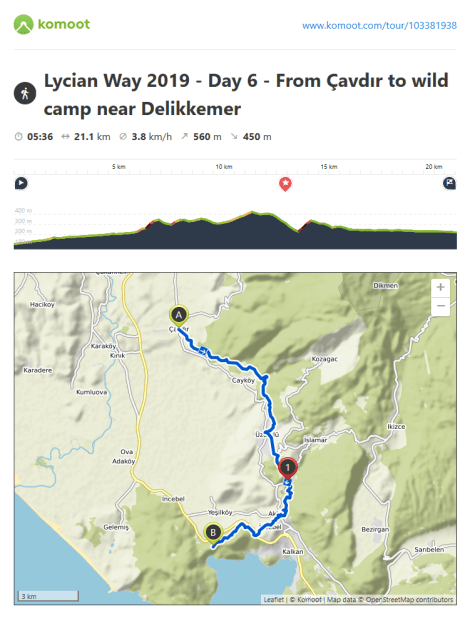
Lycian Way – route information by Komoot – day 6
We’re using Komoot* for navigation and to record our own tracks. Prior to departing the UK we uploaded the GPX tracks to Komoot so we can now use them for navigation (with voice commands). We’re also using Komoot to record our own daily tracks which gives us the above maps, elevation profiles, distance, speed etc. You can find our collection of tracks on the Komoot App by searching ToughGirl for Sarah and followingthearrows for me. Or click the link in the caption on the above map to go straight to the track.
*Komoot premium was gifted and we also received sponsorship for this hike.
To see Sarah’s vlogs of our Lycian Way hike, click here. You can also follow her on Instagram, Twitter, LinkedIn, YouTube, and keep up to date with the Tough Girl podcasts here.
If you have any questions, leave me a comment and I’ll add a FAQ post at the end of the trip.
