
- Day 4: Neyland to Dale Peninsula
- Distance: 34.9km
- Ascent / descent: 816m / 781m
- Weather: sunny and hot
After a wonderful night’s sleep (thank you friendly local in Neyland!), we set off reenergised and ready for whatever the day was going to throw at us.
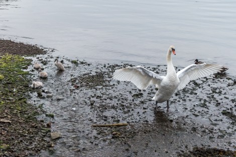
A proud parent protecting its young

Two hours after leaving, we passed through Milford Haven with its delightful marina where we had high hopes of getting a big brekkie to fuel the day. And we weren’t disappointed. The Spinnaker Cafe was open so we opted for the full Welsh breakfast, telling ourselves we needed this for the long day ahead 😉 This was the first ‘full Welsh / full English’ breakfast that I’d eaten since my gall bladder was removed at the beginning of the year, and lets just say I won’t be ordering another one anytime soon. Lesson learnt. (Nothing against Spinnaker Cafe though!)
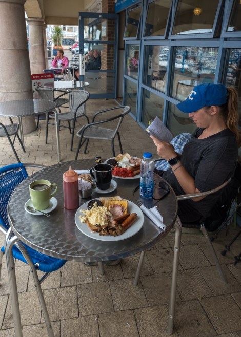
Having our first cooked breakfast of the trip, at the Spinnaker Cafe in Milford Haven
Reading in the guidebook that we wouldn’t pass another supermarket for the next 30 miles or so, we popped into the large Tesco on the way out of town for a few extra supplies. I’d completely forgotten about having my freshly washed underwear swinging off my pack (to dry in the sun) until KC noticed a few people looking at me strangely in the supermarket and through chuckles of laughter, she not so gently reminded me…
The small island off to the left of the photo is Stack Rock Fort, a 19th century fort which was apparently up for sale in 2018 for £400,000.
Heading into today, we were a little nervous as neither of us know anything about tides and we had two tidal crossings within a few miles of each other. They both had to be timed right, in order not to add on an extra 6.5 miles (9.7km) of detours. We’d read about this in the guide on the train journey from London to Wales and had looked up the suggested website (www.tidetimes.org.uk). High tide for Milford Haven (the closest area we could find to our first crossing at Sandy Haven) was at 10:31am, with low tide at 16:44. What we needed to take into account was this crossing at Sandy Haven, plus the next one at Dale four miles further on. We figured we needed to be at Sandy Haven around 2:45pm in order to be able to do both crossings…
Low-tide crossing at Sandy Haven Beach, 2:49pm
The first crossing (above pic) was almost too easy and hard to imagine not being able to cross here (until you look at google images and see this walkway completely submerged). Still not knowing if we’d done our calculations right, we covered the next four miles with a little haste!

Does anyone know what these purple flowers are? We saw two fields of them.
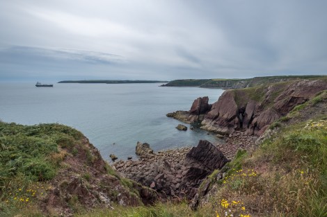
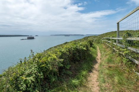
Every view is a winner on this trail (except the oil refineries of the past two days!)

Victorian watchtower remains just before Monk Haven

Victorian watchtower remains just before Monk Haven
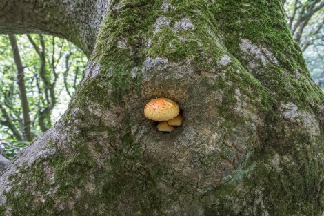
Mushrooms and moss

Mushrooms and moss
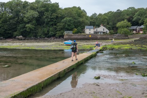
We arrived at our second tidal crossing, an estuary called The Gann near Dale, at 4:28pm. It didn’t look deep, we could see bathers standing up in the water seemingly having a jolly good time, and we liked the idea of cooling down our feet, so we headed straight across…
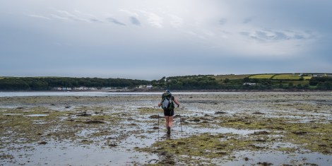
Straight over then! 4:33pm
However, straight wasn’t the most practical idea when we ended up on a beach with a cliff we couldn’t climb and had to somewhat embarrassingly veer right (backtracking) past sunbathers! Hey ho, we ended up in Dale outside the Griffin Inn pub, so, silver lining and all 🙂
Having recently made a vow to not pass up an opportunity for a cooked meal on this trip (few and far between so far), we stopped for a delicious early dinner.

Dinner (with wet feet!) at the Griffin Inn in Dale

Looking down on Watwick Bay
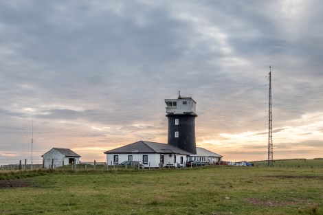
St Anne’s Head lighthouse
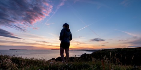
KC watching the sunset on day 4 of our Pembrokeshire Coast Path adventure
Continuing on, we witnessed another stunning sunset on what has so far been a really beautiful hike.
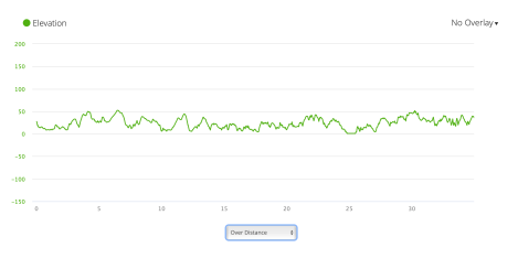
PCP4 elevation profile from Garmin Connect
