
21st November, 2019
- Day 12: Boğazcık to Demre
- Distance: 23.5km on foot and 11.8km by boat, total 35.3km
- Ascent / Descent: 290m / 580m
- Weather: sunny, 22 degrees C
- Accommodation: Kent Pansiyon, ₺85pp
- Total cost for one (Turkish Lira ₺): boat 175, dinner 30, accommodation 85 = ₺290 (~£37 / €44 / US$50)
Waking on the sofa bed in the warmth of the house, I brave the cold and visit the outside toilet. Poor Rick is trying to fix his collapsed tent and it’s also covered in condensation. I tell him to come on into the house and thaw out.
We pack and scrounge through our food bags for breakfast, then wait for the sun to rise. The owner comes in and I ask him about a boat option I’ve read about for this next section, between Aperlai and Üçağız. He makes a call to someone called Mustafa then tells us to meet this man at the ‘boathouse’ in Aperlai.
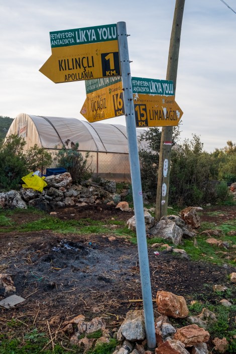
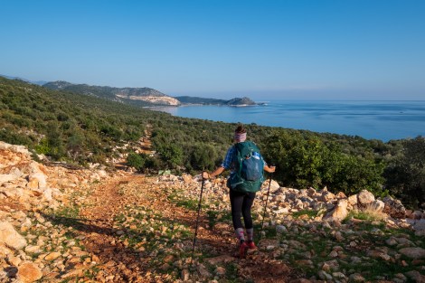
Leaving Boğazcık, we follow a road for a bit, then we’re back on a rocky and very thorny trail. **You definitely need trousers for the Lycian Way. **
8:26am
After a couple of hours, we stumble upon the Aperlai ruins, an ancient Lycian/Roman coastal city. There’s tombs – some intact and many upturned – city walls, building foundations and part of the city is also visible underwater.

Tombs at the Aperlai ruins
Taking our packs off to explore the Aperlai ruins

Aperlai ruins
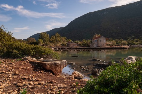
11:02 – a sunken city at the Aperlai ruins
We call Mustafa from what we think is the ‘boathouse’, and he says he’s on the way. After half an hour I call back and with some confusion, realise we’re at the wrong boathouse! Continuing a further kilometre down the trail we reach the real boathouse, complete with a boat! It’s a tiny boat and doesn’t look anything like the yacht I was picturing 😉

12:27pm – I’m not sure that’s the way Sarah…
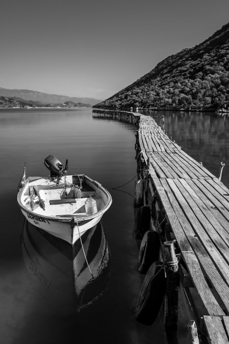
That’s our boat!
Meeting Mustafa we tell him we’d like to see the Sunken City of Kekova (accessible by boat only) and agree on a price of 350TRY (~£45) before clumsily boarding the small boat in the above picture.

1:01pm – we ‘sail’ the seas with Captain Mustafa
The sky is blue, the water shimmers and the scenery is picture-postcard. Life is good.
Mustafa pulls the boat into a small cove and we pass two gulets who’ve also dropped anchor. “Is this the sunken city?” We ask. “No, you swim,” Mustafa replies. It’s hot anyway and we really are in the perfect spot for a swim, but aren’t you supposed to be culturally appropriate and not strip down to your underwear in front of a Turkish man?!… Oh well, in we go and it’s heaven. In fact, I’m in paradise! The water feels smooth on my skin and the sticky sweat covering my body is washed away.
Eventually we get back in the boat and cover up quickly. Next stop: Sunken City of Kekova.

Passing the Sunken City of Kekova

Bye Mustafa

2:39pm – a room with a view – medieval castle ruins
Back on the trail we hug the coastline, up and down over rocky paths (always looking out for cairns just as much as red and white blazes) and across the pebble Cakil beach before arriving at the small harbour of Çayağzı.
3:30pm – continuing by foot

Harvesting the olives

4:22pm – cairns and coast at Cakil beach

My, what a big bell you have

5:03pm – um, you wanna go first Sarah?!
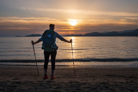
5:11pm – Sarah admiring the sunset at Çayağzı Beach
In Çayağzı we meet the D400 main road and follow this the remaining 5km to Demre. Luckily there’s a footpath and street lights as it’s getting dark quickly. We don’t know where we’re going to stay, but the priority is dinner. Get dinner, look at the options then make decisions.
-

- In the spirit of trying something new, I opt for Konya Saç Arası for dessert – it’s tastier than it looks!
-

- 6:29pm – I’m really into the chicken kebabs and Sarah loves lahmacun
We have a slight issue. The next section of trail between Demre and Finike is a three-day mountainous stage and apparently there’s no water. This means carrying enough for the duration. Impossible! After quite a lot of googling we find a pension nearby that offers a transport service allowing us to base ourselves there for the next three nights and be picked up and dropped off at various locations along the mountain. As far as we can see, it’s our only option other than skipping the section entirely.
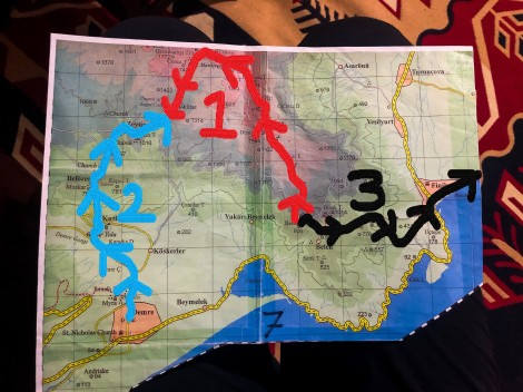
Our plan to tackle the mountain section between Demre and Finike over the next three days
I call the pension* and they have a room available. On arrival, we’re shown the above map and explained the best way to tackle the next three days, taking into account there’s rain forecast for each day. We’ll start with the middle red section from Belos to Alakilise, then the next day we’ll do the blue section walking from the pension uphill to Alakilise, then on the final day we’ll be dropped off at Belos again and walk downhill towards Finike. It makes sense so we agree and hit the sack.
*I feel I should point out that after more research we found a bad review of this pension written by a woman who stayed here by herself. If you’re a female travelling solo, you might want to give it a read.

Lycian Way – route information by Komoot – day 12
We’re using Komoot* for navigation and to record our own tracks. Prior to departing the UK we uploaded the GPX tracks to Komoot so we can now use them for navigation (with voice commands). We’re also using Komoot to record our own daily tracks which gives us the above maps, elevation profiles, distance, speed etc. You can find our collection of tracks on the Komoot App by searching ToughGirl for Sarah and followingthearrows for me. Or click the link in the caption on the above map to go straight to the track.
*Komoot premium was gifted and we also received sponsorship for this hike.
To see Sarah’s vlogs of our Lycian Way hike, click here. You can also follow her on Instagram, Twitter, LinkedIn, YouTube, and keep up to date with the Tough Girl podcasts here.
If you have any questions, leave me a comment and I’ll add a FAQ post at the end of the trip.
