
22nd November, 2019
- Day 13: Belos ruins to Alakilise
- Distance: 18.3km
- Ascent / Descent: 1010m / 910m
- Weather: cool and overcast
- Accommodation: Kent Pansiyon ₺100pp including dinner
- Total cost for one (Turkish Lira ₺): accommodation 100, transfer to Belos 75, pick-up from Alakilise 75 = ₺250 (~£32 / €38 / US$43)
The alarm goes off at 6:30am and we’re in the car at 7am, driving for an hour along the coastal road as the sun rises. Eventually we turn off onto a bumpy dirt road to reach the far side of the mountain near Belos. A pick-up time of 4pm is arranged at Alakilise and then we set off, up the hill. Starting at 823m high, it’s noticeably colder, but this is fine as long as we don’t stop!
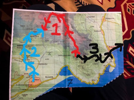
Our plan to tackle the mountain section between Demre and Finike over the next three days – starting today with the middle red section

8:30am – ancient tombs
From looking at the elevation profile we’ve got quite the climb and are feeling the pressure to hurry because of the rain forecast for the early afternoon. Today’s mantra is ‘get off the mountain before the rain!’ Having left most of the contents of our packs at the pension it’s a considerably easier ascent than expected, however the waymarks are more lacking than usual, and better marked in the opposite direction.

8:57am – we’ve got quite a climb today
9:34am – passing a well

10:25am – first time to see cows on the Lycian Way

Pops of autumn colour dot the landscape
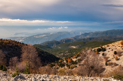
10:55am – there’s a storm brewing as we take a break and look back towards the sea

This is what I’m using to filter all my water for this trip
Trying to find waymarks while sliding down scree (when attempting to ascend) is quite a frustrating task and eventually we switch to relying purely on following the GPS. The descent is even worse, largely on scree and there’s not a waymark in sight. Maybe most people skip this section for a reason? The clouds are closing in and the wind is picking up. In our haste to finish before the rain, we’re ahead of schedule so when I finally get phone service (I wasn’t expecting any) I call and ask the owner if he can pick us up at 2:30pm instead of 4pm.
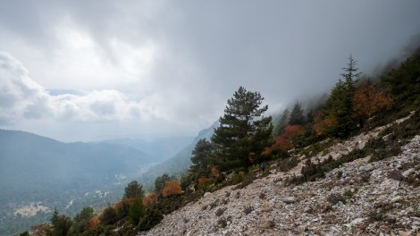
1:41pm – can we make it to the rendezvous point before the rain?
My knees are like jelly when we arrive at the rendezvous point and I’m glad to be off scree and on solid ground. Our ride is waiting and within minutes of getting in the car, the heavens open and torrential rain falls.
The drive is bumpy and the car rattles and shakes as we skirt around the mountain on an old dirt road. It’s hair-raising!

3:21pm – strawberry tree fruit (Arbutus unedo)
Back at the pension, we eat dinner with the family and have chicken stew, rice and salad. It turns out there was water in wells along this stretch today, but hindsight is wonderful isn’t it?! Tomorrow, we’ll walk from the pension up to Alakilise and then be picked up and driven back. (Our knees prefer climbing to descending!)
-

- A retro slow-cooker at our accommodation
-

- Chicken stew for dinner
-

- Delicious!
-
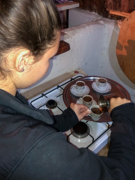
- Our host’s daughter shows me how to make Turkish coffee
-
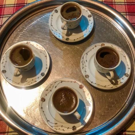
- Turkish coffee – don’t drink the brown sludge at the bottom!
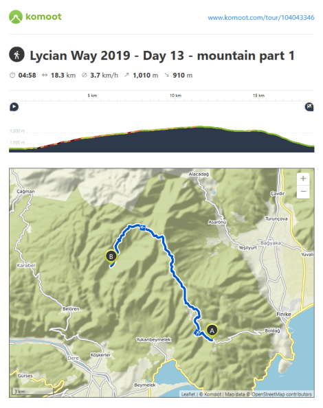
Lycian Way – route information by Komoot – day 13
We’re using Komoot* for navigation and to record our own tracks. Prior to departing the UK we uploaded the GPX tracks to Komoot so we can now use them for navigation (with voice commands). We’re also using Komoot to record our own daily tracks which gives us the above maps, elevation profiles, distance, speed etc. You can find our collection of tracks on the Komoot App by searching ToughGirl for Sarah and followingthearrows for me. Or click the link in the caption on the above map to go straight to the track.
*Komoot premium was gifted and we also received sponsorship for this hike.
To see Sarah’s vlogs of our Lycian Way hike, click here. You can also follow her on Instagram, Twitter, LinkedIn, YouTube, and keep up to date with the Tough Girl podcasts here.
If you have any questions, leave me a comment and I’ll add a FAQ post at the end of the trip.
