
28th November, 2019
- Day 19: wildcamp 6km past Çıralı to wildcamp before Çamyuva
- Distance: 24.6km
- Ascent / Descent: 500m / 560m
- Weather: overcast, 17 degrees C
- Accommodation: wildcamp before Çamyuva
- Total cost for one (Turkish Lira ₺): lunch in Tekirova 31, resupply 5 = ₺36 (~£4 / €5 / US$6)
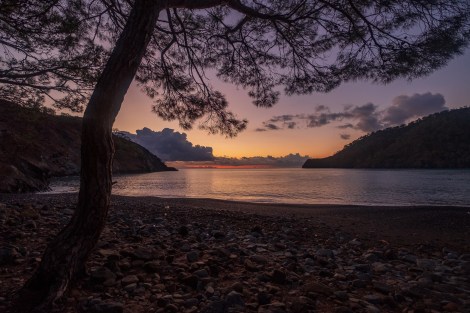
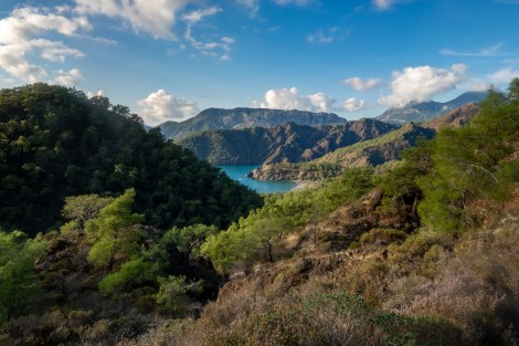
7:39am – starting the day with a gorgeous sunrise
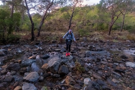
8:12am – obstacle #1
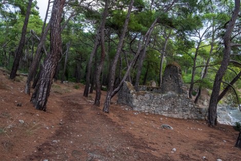
Again, this stage is well waymarked and it’s a nice surprise. It would be interesting to know the numbers of hikers who walk this coastal alternative rather than the Mt Olympos trail. It appears to be well-trodden.
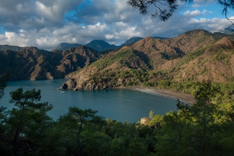
9:05am – where we’ve come from this morning
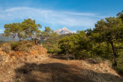
9:14am – our first view of Mount Tahtalı (Tahtalı Dağı), also known as Mt Olympos
12:52pm
We emerge from the forest into the resort town of Tekirova where there’s more signs in Russian than Turkish. The shutters are down on the markets and cafes; the only shops open are selling fur coats, leather and fancy handbags – it feels a little odd. Famished, we’re desperately hoping to find somewhere to eat.

1:14pm – let sleeping dogs lie (especially in Turkey when all they do is bark when they’re awake!)
Finding the one and only open cafe, we refuel (with Turkish savoury pastries and baklava), rehydrate and charge our electronics.
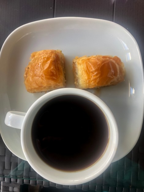
2:07pm – baklava face
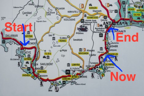
Our current location
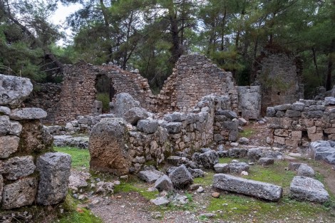
With our bellies full, we leave Tekirova and follow the trail to reach another ancient site: Phaselis. Founded by the Rhodians around 690BC, control of this harbour city was overtaken by Persians, Lycians, Greeks, Romans… There’s a lot to see including a theatre, a main avenue with private houses, an aqueduct, engravings, columns and lots more. It appears more ‘intact’ than the nearby Olympos ruins we passed through yesterday. We’re not alone in visiting it either. Although we’ve accessed it along the coast via what seems like a secluded trail, there’s a road entrance with a number of parked coaches and more people in tour groups than I’ve seen during our whole trip.
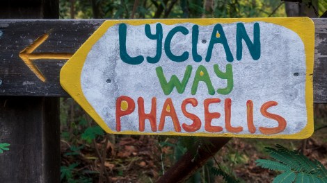
3:22pm – this way to Phaselis
-
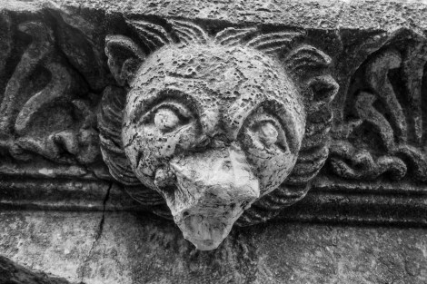
- A bears head? At Phaselis ruins
-
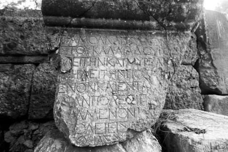
- I can see my name (Kat) written on that stone!
-
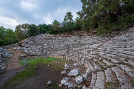
- Ruins of an amphitheatre at Phaselis
-
- Ruins of buildings at Phaselis
4:33pm – continuing on the Lycian Way and passing the ruins of Phaselis
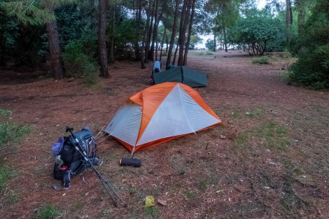
5:34pm – setting up our home for the night
We’re still on the ‘coastal alternative’ but tomorrow we venture off onto our own coastal trail that we’ve devised to link up to Göynük Canyon.
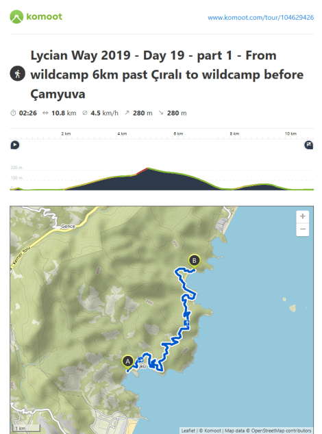
Lycian Way – route information by Komoot – day 19 (part 1)
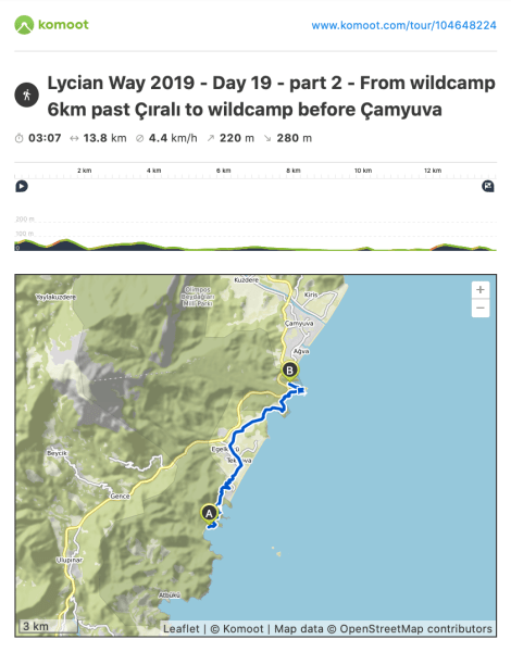
Lycian Way – route information by Komoot – day 19 (part 2)
We’re using Komoot* for navigation and to record our own tracks. Prior to departing the UK we uploaded the GPX tracks to Komoot so we can now use them for navigation (with voice commands). We’re also using Komoot to record our own daily tracks which gives us the above maps, elevation profiles, distance, speed etc. You can find our collection of tracks on the Komoot App by searching ToughGirl for Sarah and followingthearrows for me. Or click the link in the caption on the above map to go straight to the track.
*Komoot premium was gifted and we also received sponsorship for this hike.
To see Sarah’s vlogs of our Lycian Way hike, click here. You can also follow her on Instagram, Twitter, LinkedIn, YouTube, and keep up to date with the Tough Girl podcasts here.
If you have any questions, leave me a comment and I’ll add a FAQ post at the end of the trip.
